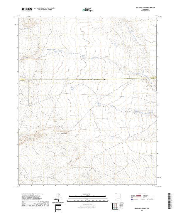
2023 Map of Comanche Ranch
USGS Topo · Published 2023About this map
Arroyo Monte Largo and Arroyo Comanche define the drainage patterns of this high desert landscape along the border of Socorro and Valencia counties. The region is characterized by an extensive network of water management features essential for ranching in an arid environment, including the Monte Largo Tank, Heredura Tank, and Middle Tank. These artificial catchments, often named for local families or landmarks like the Click Tank Number 7 and Click Tank Number 2, reveal the infrastructure of modern New Mexico land use. Central to the southern portion of the map is the broad Coyote Draw, which is fed by the vital Coyote Spring. This terrain, while appearing sparse, is etched with the history of water rights and grazing, accessible via the remote track of Co RD 12.
Find a feature on this map
25 named features on this map. Tap any name to fly to it.
Don’t see what you’re looking for? This feature index may not catch every label — zoom into the map to look around manually.
Map Details
Editions of this 2023 Comanche Ranch Map
This is the sole edition of this map. No revisions or reprints were ever made.
Other maps of this area

1916 · La Joya
USGS Topo · 1:125,000

1917 · Cerro Verde
USGS Topo · 1:125,000

1952 · La Joya NW
USGS Topo · 1:24,000

1952 · Belen SW
USGS Topo · 1:24,000

1952 · Belen NW
USGS Topo · 1:24,000

1954 · Socorro
USGS Topo · 1:250,000

1956 · Mesa Aparejo
USGS Topo · 1:62,500

1958 · Socorro
USGS Topo · 1:250,000

1959 · Riley
USGS Topo · 1:62,500

1962 · Socorro
USGS Topo · 1:250,000