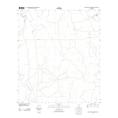
2013 Map of Comanche Waterhole
USGS Topo · Published 2013About this map
Comanche Waterhole sits at the heart of this Medina County landscape, where the arid terrain is defined by a network of seasonal drainages and creek beds. The map illustrates a ranching-focused economy, anchored by large-scale properties such as Valdina Farms and K Bar Ranch, which includes the K Bar Ranch Airport. The hydrography of the region is complex, with the Sabinal River cutting through the western edge while numerous tributaries like Rancheros Cr, Comanche Cr, and Little Comanche Cr crisscross the central and eastern sections. This 2013 survey provides a clear view of the rural infrastructure in the Texas Hill Country, showing the transition from state-maintained routes like Ranch Road 187 and Ranch Road 1796 to the local county and private roads that provide access to these expansive livestock and agricultural operations.
Find a feature on this map
19 named features on this map. Tap any name to fly to it.
Don’t see what you’re looking for? This feature index may not catch every label — zoom into the map to look around manually.
Map Details
Editions of this 2013 Comanche Waterhole Map
This is the sole edition of this map. No revisions or reprints were ever made.
Other maps of this area

1898 · Uvalde
USGS Topo · 1:125,000

1899 · Uvalde
USGS Topo · 1:125,000

1954 · San Antonio
USGS Topo · 1:250,000

1956 · Sabinal
USGS Topo · 1:62,500

1956 · Tarpley
USGS Topo · 1:62,500

1956 · Utopia
USGS Topo · 1:62,500

1957 · San Antonio
USGS Topo · 1:250,000
1969 · Texas Mountain
USGS Topo · 1:24,000

1969 · Sabinal NE
USGS Topo · 1:24,000

1969 · Comanche Waterhole
USGS Topo · 1:24,000