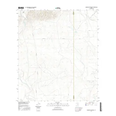
2016 Map of Comanche Waterhole
USGS Topo · Published 2016About this map
The Comanche Waterhole sits at the heart of this landscape where the Uvalde Co Medina Co line divides the ranchlands of South Texas. This 2016 survey highlights a region defined by its water management and aviation history, centered on the K Bar Ranch Airport and the neighboring K-Bar Ranch Lake. A complex network of drainages, including the Sabinal River and Seco Cr, cross the terrain, illustrating the hydrological patterns critical to the area's agricultural operations.
Find a feature on this map
21 named features on this map. Tap any name to fly to it.
Don’t see what you’re looking for? This feature index may not catch every label — zoom into the map to look around manually.
Map Details
Editions of this 2016 Comanche Waterhole Map
This is the sole edition of this map. No revisions or reprints were ever made.
Other maps of this area

1898 · Uvalde
USGS Topo · 1:125,000

1899 · Uvalde
USGS Topo · 1:125,000

1954 · San Antonio
USGS Topo · 1:250,000

1956 · Sabinal
USGS Topo · 1:62,500

1956 · Tarpley
USGS Topo · 1:62,500

1956 · Utopia
USGS Topo · 1:62,500

1957 · San Antonio
USGS Topo · 1:250,000
1969 · Texas Mountain
USGS Topo · 1:24,000

1969 · Sabinal NE
USGS Topo · 1:24,000

1969 · Comanche Waterhole
USGS Topo · 1:24,000