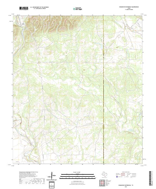
2022 Map of Comanche Waterhole
USGS Topo · Published 2022About this map
Comanche Waterhole sits at the heart of this landscape along the border of Uvalde Co and Medina Co. This ranchland region is defined by a dense network of intermittent drainages, including Comanche Cr and Rancheros Cr, which flow through the dissected terrain towards the Sabinal River in the west. The presence of the K Bar Ranch Airport in the northwest corner highlights the importance of private aviation in managing these large Texas landholdings. Transportation is facilitated by a grid of rural routes such as N Ranch Rd 187 and Ranch Rd 1796, connecting isolated homesteads across the Edwards Plateau foothills. This map documents a traditional ranching environment where water sources like Little Seco Cr and Elm Cr remain the primary landmarks for navigation and land division.
Find a feature on this map
20 named features on this map. Tap any name to fly to it.
Don’t see what you’re looking for? This feature index may not catch every label — zoom into the map to look around manually.
Map Details
Editions of this 2022 Comanche Waterhole Map
This is the sole edition of this map. No revisions or reprints were ever made.
Other maps of this area

1898 · Uvalde
USGS Topo · 1:125,000

1899 · Uvalde
USGS Topo · 1:125,000

1954 · San Antonio
USGS Topo · 1:250,000

1956 · Sabinal
USGS Topo · 1:62,500

1956 · Tarpley
USGS Topo · 1:62,500

1956 · Utopia
USGS Topo · 1:62,500

1957 · San Antonio
USGS Topo · 1:250,000
1969 · Texas Mountain
USGS Topo · 1:24,000

1969 · Sabinal NE
USGS Topo · 1:24,000

1969 · Comanche Waterhole
USGS Topo · 1:24,000