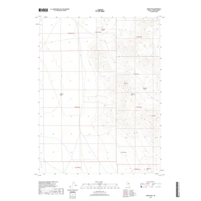
2018 Map of Combs Peak
USGS Topo · Published 2018About this map
Antelope Valley spreads across the western reach of this Eureka County landscape, transitioning into the prominent uplands of the Mahogany Hills. The terrain is defined by a series of high points and deeply cut drainages, most notably Combs Peak and the nearby Wood Cone Peak in the southeast. This 2018 survey reveals a topography characterized by steep slopes and isolated summits such as Table Mtn. The eastern half of the map is a network of named canyons including Denio Canyon, Dougherty Canyon, and Combs Canyon, which collect the seasonal runoff from the surrounding peaks. This area represents a classic Great Basin environment where flat alluvial plains meet sharp, distinct mountain ranges, captured through precise modern contour mapping.
Find a feature on this map
16 named features on this map. Tap any name to fly to it.
Don’t see what you’re looking for? This feature index may not catch every label — zoom into the map to look around manually.
Map Details
Editions of this 2018 Combs Peak Map
This is the sole edition of this map. No revisions or reprints were ever made.
Other maps of this area

1926 · Roberts Mountains
USGS Topo · 1:250,000

1929 · Roberts Mountains
USGS Topo · 1:250,000

1955 · Millett
USGS Topo · 1:250,000

1956 · Bellevue Peak
USGS Topo · 1:62,500

1956 · Bartine Ranch
USGS Topo · 1:62,500

1956 · Antelope Peak
USGS Topo · 1:62,500

1956 · Whistler Mtn
USGS Topo · 1:62,500

1959 · Millett
USGS Topo · 1:250,000

1978 · Summit Mountain
USGS Topo · 1:100,000

1979 · Simpson Park Mtns
USGS Topo · 1:100,000