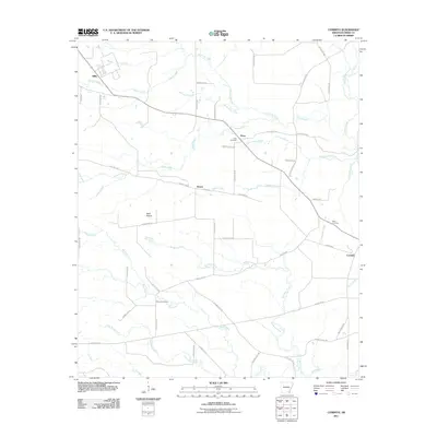
2011 Map of Cominto
USGS Topo · Published 2011About this map
Wolf Prairie occupies a central position in this corner of Drew County, Arkansas, where the landscape is defined by a dense network of creek drainages. Small settlements such as Enon, Deane, and Cominto are scattered across the terrain, connected by a web of local routes like Old Troy Rd and Enon Deane Rd. The hydrology of the area is particularly complex, with Hurricane Creek and its tributary Puncheon Creek in the north giving way to the southern reaches of Rainbow Creek and Wolf Creek. Genealogists and local historians can find significant value in the distribution of family-named landmarks and local burial sites, including the Enon Cemetery, Moore Cemetery, and Rash Cemetery, which provide clues to the region's historic rural settlement patterns. The presence of roads like Caraway Dirt Rd and New Light Rd suggests the persistence of older transport paths through the low-lying bottoms and prairie edges.
Find a feature on this map
57 named features on this map. Tap any name to fly to it.
Don’t see what you’re looking for? This feature index may not catch every label — zoom into the map to look around manually.
Map Details
Editions of this 2011 Cominto Map
This is the sole edition of this map. No revisions or reprints were ever made.
Other maps of this area

1935 · Mist
USGS Topo · 1:62,500

1935 · Cominto
USGS Topo · 1:62,500

1953 · Greenwood
USGS Topo · 1:250,000

1956 · Greenwood
USGS Topo · 1:250,000

1960 · Mist
USGS Topo · 1:62,500

1960 · Selma
USGS Topo · 1:24,000

1960 · Collins NW
USGS Topo · 1:24,000

1960 · Collins
USGS Topo · 1:24,000

1960 · Collins
USGS Topo · 1:62,500
1960 · Line
USGS Topo · 1:24,000