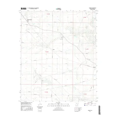
2017 Map of Cominto
USGS Topo · Published 2017About this map
The low-lying timber and agricultural lands of Drew County are defined by a complex drainage network feeding into Hurricane Cr and Rainbow Cr. Small rural settlements like Enon, Deane, and Cominto anchor a landscape crisscrossed by named tracks and farm roads, including the descriptive Paradise Rd and Dead Horse Trl. These communities, while small, maintain a clear presence through local landmarks such as Enon Cem and Moore Cem, which serve as vital points for genealogical research in this part of Arkansas. The terrain is characterized by numerous small watercourses like Sandy Cr and Wolf Cr, which have historically dictated the placement of homesteads and the winding paths of the county road system. The map captures a moment of quiet continuity in the Arkansas Delta region, where the naming of even small branches like Dickie Br reflects the deep local ties to the land.
Find a feature on this map
65 named features on this map. Tap any name to fly to it.
Don’t see what you’re looking for? This feature index may not catch every label — zoom into the map to look around manually.
Map Details
Editions of this 2017 Cominto Map
This is the sole edition of this map. No revisions or reprints were ever made.
Other maps of this area

1935 · Mist
USGS Topo · 1:62,500

1935 · Cominto
USGS Topo · 1:62,500

1953 · Greenwood
USGS Topo · 1:250,000

1956 · Greenwood
USGS Topo · 1:250,000

1960 · Mist
USGS Topo · 1:62,500

1960 · Selma
USGS Topo · 1:24,000

1960 · Collins NW
USGS Topo · 1:24,000

1960 · Collins
USGS Topo · 1:24,000

1960 · Collins
USGS Topo · 1:62,500
1960 · Line
USGS Topo · 1:24,000