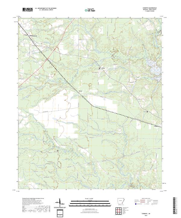
2024 Map of Cominto
USGS Topo · Published 2024About this map
Hurricane Creek and Sandy Creek define the drainage of this southeastern Arkansas landscape, where timber and agriculture intersect in Drew County. The settlement pattern is characterized by scattered rural communities like Deane, Enon, and Cominto, connected by a network of local roads such as Ott Pace Rd and Rash Crossing Rd. The map reveals a deeply established rural geography where family landmarks and small-scale infrastructure remain central to the identity of the area.
Find a feature on this map
63 named features on this map. Tap any name to fly to it.
Don’t see what you’re looking for? This feature index may not catch every label — zoom into the map to look around manually.
Map Details
Editions of this 2024 Cominto Map
This is the sole edition of this map. No revisions or reprints were ever made.
Other maps of this area

1935 · Mist
USGS Topo · 1:62,500

1935 · Cominto
USGS Topo · 1:62,500

1953 · Greenwood
USGS Topo · 1:250,000

1956 · Greenwood
USGS Topo · 1:250,000

1960 · Mist
USGS Topo · 1:62,500

1960 · Selma
USGS Topo · 1:24,000

1960 · Collins NW
USGS Topo · 1:24,000

1960 · Collins
USGS Topo · 1:24,000

1960 · Collins
USGS Topo · 1:62,500
1960 · Line
USGS Topo · 1:24,000