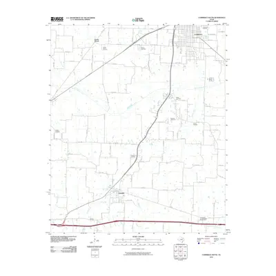
2010 Map of Commerce South
USGS Topo · Published 2010About this map
Commerce anchors the northern portion of this Hunt County landscape, where the street grid of the town transitions into the agricultural reaches of northeast Texas. The South Sulphur River meanders across the center of the sheet, joined by numerous tributaries including Scatter Branch, Dunbar Creek, and West Caney Creek. This network of waterways is punctuated by small impoundments such as Adams Lake Dam and the Louisiana and Arkansas RR Lake Dam. For genealogists and local historians, the map is a dense record of family and community heritage, preserving the locations of several burial grounds like Rosemound Cemetery, Brigham Cemetery, and Shiloh Cemetery. Farther south, the town of Campbell sits near the crossing of several county roads, illustrating the area's continued reliance on a mix of local farm-to-market routes and established railroad corridors.
Find a feature on this map
82 named features on this map. Tap any name to fly to it.
Don’t see what you’re looking for? This feature index may not catch every label — zoom into the map to look around manually.
Map Details
Editions of this 2010 Commerce South Map
This is the sole edition of this map. No revisions or reprints were ever made.
Other maps of this area

1953 · Texarkana
USGS Topo · 1:250,000

1954 · Sherman
USGS Topo · 1:250,000

1956 · Texarkana
USGS Topo · 1:250,000

1958 · Sherman
USGS Topo · 1:250,000

1962 · Greenville SE
USGS Topo · 1:24,000

1962 · Lone Oak North
USGS Topo · 1:24,000

1962 · Miller Grove
USGS Topo · 1:24,000

1963 · Greenville NE
USGS Topo · 1:24,000

1964 · Cumby
USGS Topo · 1:24,000

1964 · Commerce South
USGS Topo · 1:24,000