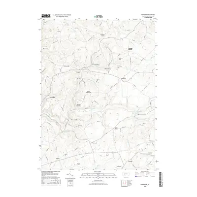
2016 Map of Commodore
USGS Topo · Published 2016About this map
Commodore serves as a central hub for a network of coal-country settlements in Rayne Township, including Diamondville, Starford, and Kenwood. The landscape is defined by the legacy of the Purchase Line and the winding paths of N Br Two Lick Cr and S Br Two Lick Cr. Local history is preserved in small family and community burial grounds such as Diamondville Cem, Saint Elizabeths Cem, and Bethesda Cem. The area maintains its rural character with locations like Learn Settlement and Wandin Junction situated among numerous hills, including Turkey Knob and Buck Hill. Near the southern boundary, Heilwood and Jewtown sit just above Yellow Cr, while Downes Airport provides a small aviation footprint in an area otherwise dominated by ridge-top roads and creek-valley hamlets. This survey provides a clear look at the distribution of homes and rural structures along routes like Cookport Rd and Fleming Summit Rd.
Find a feature on this map
96 named features on this map. Tap any name to fly to it.
Don’t see what you’re looking for? This feature index may not catch every label — zoom into the map to look around manually.
Map Details
Editions of this 2016 Commodore Map
This is the sole edition of this map. No revisions or reprints were ever made.
Other maps of this area

1902 · Indiana
USGS Topo · 1:62,500

1902 · Barnesboro
USGS Topo · 1:62,500

1904 · Barnesboro
USGS Topo · 1:62,500

1906 · Punxsutawney
USGS Topo · 1:62,500

1909 · Smicksburg
USGS Topo · 1:62,500

1938 · Smicksburg
USGS Topo · 1:62,500

1939 · Smicksburg
USGS Topo · 1:62,500

1939 · Punxsutawney
USGS Topo · 1:62,500

1942 · Punxsutawney
USGS Topo · 1:62,500

1943 · Punxsutawney
USGS Topo · 1:125,000
Featured Places
- Rayne Township, PA
- Pine Township, PA
- Mentcle, Pine Township
- Buck Run, Cherryhill Township
- Manor, Cherryhill Township