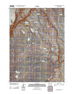
2011 Map of Commodore Ridge
USGS Topo · Published 2011About this map
Pike Ranch sits in the northwest corner of this high-desert landscape, where water management is the primary defining feature of the terrain. The presence of numerous named waterholes and reservoirs, such as Hard Pan Reservoir, Skookum Lake Waterhole, and Soup Lake Waterhole, underscores the critical importance of water for livestock and land management in Lake County. The topographic prominence of Commodore Ridge runs through the center of the sheet, dividing the drainages of Foley Creek and Rabbit Creek.
Find a feature on this map
22 named features on this map. Tap any name to fly to it.
Don’t see what you’re looking for? This feature index may not catch every label — zoom into the map to look around manually.
Map Details
Editions of this 2011 Commodore Ridge Map
This is the sole edition of this map. No revisions or reprints were ever made.
Other maps of this area

1955 · Klamath Falls
USGS Topo · 1:250,000

1955 · Adel
USGS Topo · 1:250,000

1957 · Adel
USGS Topo · 1:250,000

1958 · Klamath Falls
USGS Topo · 1:250,000

1958 · Adel
USGS Topo · 1:250,000

1962 · Adel
USGS Topo · 1:250,000

1966 · Rabbit Hills NW
USGS Topo · 1:24,000

1967 · Rabbit Hills SW
USGS Topo · 1:24,000

1968 · Lake Abert North
USGS Topo · 1:24,000

1968 · Lake Abert South
USGS Topo · 1:24,000