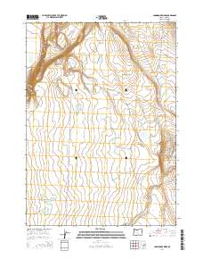
2014 Map of Commodore Ridge
USGS Topo · Published 2014About this map
Abert Rim dominates the western edge of this high-desert landscape in Lake County, dropping sharply toward the Lakeview-Burns Hwy. This 2014 survey reveals a terrain defined by intermittent water sources and the prominence of Commodore Ridge. These scattered water features, including Hard Pan Reservoir, Boy Lake Waterhole, and Skookum Lake Waterhole, suggest a land utilized for seasonal grazing and wildlife management.
Find a feature on this map
34 named features on this map. Tap any name to fly to it.
Don’t see what you’re looking for? This feature index may not catch every label — zoom into the map to look around manually.
Map Details
Editions of this 2014 Commodore Ridge Map
This is the sole edition of this map. No revisions or reprints were ever made.
Other maps of this area

1955 · Klamath Falls
USGS Topo · 1:250,000

1955 · Adel
USGS Topo · 1:250,000

1957 · Adel
USGS Topo · 1:250,000

1958 · Klamath Falls
USGS Topo · 1:250,000

1958 · Adel
USGS Topo · 1:250,000

1962 · Adel
USGS Topo · 1:250,000

1966 · Rabbit Hills NW
USGS Topo · 1:24,000

1967 · Rabbit Hills SW
USGS Topo · 1:24,000

1968 · Lake Abert North
USGS Topo · 1:24,000

1968 · Lake Abert South
USGS Topo · 1:24,000