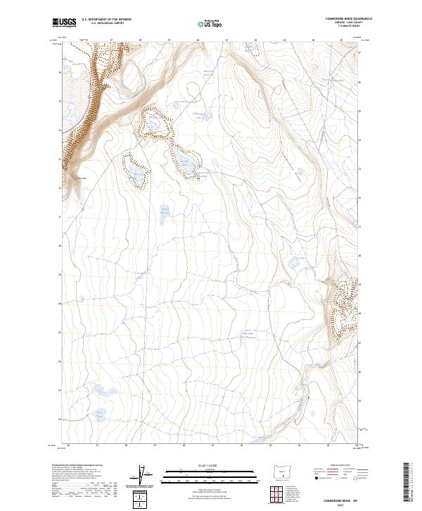
2023 Map of Commodore Ridge
USGS Topo · Published 2023About this map
Commodore Ridge and the dramatic escarpment of Abert Rim dominate this high-desert landscape in Lake County, Oregon. This 2023 survey by the U.S. Geological Survey details a region defined by scattered waterholes and ephemeral basins, including Hard Pan Reservoir and the uniquely named Feather Bed Lake. The terrain is marked by seasonal drainage systems such as Foley Creek and Rabbit Creek, which carve through the volcanic topography. A network of unimproved roads, including Hogback Rd and Corn Lake Rd, provides access across the ridge and toward the clustered water features of Soup Lakes and Twin Lakes. The map reveals a land managed for its water resources, highlighting numerous livestock and wildlife points like Draw Fork Waterhole and Boy Lake Waterhole.
Find a feature on this map
25 named features on this map. Tap any name to fly to it.
Don’t see what you’re looking for? This feature index may not catch every label — zoom into the map to look around manually.
Map Details
Editions of this 2023 Commodore Ridge Map
This is the sole edition of this map. No revisions or reprints were ever made.
Other maps of this area

1955 · Klamath Falls
USGS Topo · 1:250,000

1955 · Adel
USGS Topo · 1:250,000

1957 · Adel
USGS Topo · 1:250,000

1958 · Klamath Falls
USGS Topo · 1:250,000

1958 · Adel
USGS Topo · 1:250,000

1962 · Adel
USGS Topo · 1:250,000

1966 · Rabbit Hills NW
USGS Topo · 1:24,000

1967 · Rabbit Hills SW
USGS Topo · 1:24,000

1968 · Lake Abert North
USGS Topo · 1:24,000

1968 · Lake Abert South
USGS Topo · 1:24,000