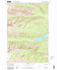
1964 Map of Como Peaks
USGS Topo · Published 1986About this map
Lake Como and the high elevations of the Bitterroot Range dominate this 1964 survey, which documents the primitive backcountry before modern developments altered the wilderness periphery. The map centers on the Bitterroot National Forest and the Selway-Bitterroot Wilderness, where a network of Pack Trails provided the only access to high-altitude landmarks like Brandy Peak and Koch Mountain.
Find a feature on this map
20 named features on this map. Tap any name to fly to it.
Don’t see what you’re looking for? This feature index may not catch every label — zoom into the map to look around manually.
Map Details
Editions of this 1964 Como Peaks Map
2 editions found
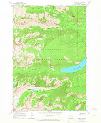
Other maps of this area

1901 · Hamilton
USGS Topo · 1:125,000

1956 · Elk City
USGS Topo · 1:250,000

1956 · Hamilton
USGS Topo · 1:250,000

1959 · Hamilton
USGS Topo · 1:250,000

1960 · Elk City
USGS Topo · 1:250,000

1960 · Hamilton
USGS Topo · 1:250,000

1964 · Hamilton
USGS Topo · 1:250,000

1964 · Hamilton South
USGS Topo · 1:24,000

1964 · Burnt Ridge
USGS Topo · 1:24,000

1964 · Tenmile Lake
USGS Topo · 1:24,000