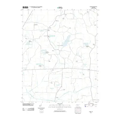
2010 Map of Como
USGS Topo · Published 2010About this map
Garrett Lake and a series of flood control reservoirs define the water-rich landscape of Weakley County on this 2010 survey. The rural character of the area is emphasized by a dense network of country roads, such as Hawks Loop Rd and Wesley Chapel Rd, connecting numerous family and community burial grounds. Genealogy researchers will find significant value in the mapped locations of Little Zion Cemetery, Olive Branch Cemetery, and Allman Cemetery.
Find a feature on this map
93 named features on this map. Tap any name to fly to it.
Don’t see what you’re looking for? This feature index may not catch every label — zoom into the map to look around manually.
Map Details
Editions of this 2010 Como Map
This is the sole edition of this map. No revisions or reprints were ever made.
Other maps of this area

1936 · Crossland
USGS Topo · 1:24,000

1950 · Osage
USGS Topo · 1:24,000

1950 · Cottage Grove
USGS Topo · 1:24,000

1952 · Dresden
USGS Topo · 1:24,000

1955 · Henry
USGS Topo · 1:24,000

1956 · Latham
USGS Topo · 1:24,000
1956 · Palmersville
USGS Topo · 1:24,000

1956 · Dyersburg
USGS Topo · 1:250,000

1957 · Como
USGS Topo · 1:24,000

1967 · Pillowville
USGS Topo · 1:24,000