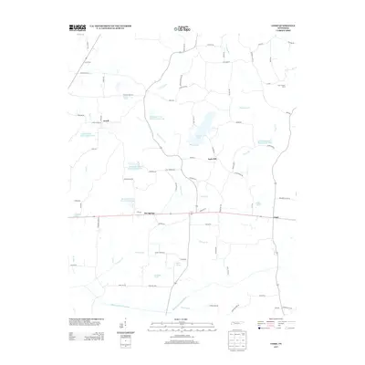
2013 Map of Como
USGS Topo · Published 2013About this map
The Middle Fork Obion River and its accompanying Steel Levee define the southern reaches of this West Tennessee landscape, where small rural settlements are scattered amidst a dense network of creeks and managed water bodies. The community of Ore Springs serves as a central point along the east-west corridor, while Como sits to the east, illustrating the long-standing agricultural pattern of the region.
Find a feature on this map
81 named features on this map. Tap any name to fly to it.
Don’t see what you’re looking for? This feature index may not catch every label — zoom into the map to look around manually.
Map Details
Editions of this 2013 Como Map
This is the sole edition of this map. No revisions or reprints were ever made.
Other maps of this area

1936 · Crossland
USGS Topo · 1:24,000

1950 · Osage
USGS Topo · 1:24,000

1950 · Cottage Grove
USGS Topo · 1:24,000

1952 · Dresden
USGS Topo · 1:24,000

1955 · Henry
USGS Topo · 1:24,000

1956 · Latham
USGS Topo · 1:24,000
1956 · Palmersville
USGS Topo · 1:24,000

1956 · Dyersburg
USGS Topo · 1:250,000

1957 · Como
USGS Topo · 1:24,000

1967 · Pillowville
USGS Topo · 1:24,000