
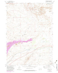
1971 Map of Como West
USGS Topo · Published 1975About this map
The Union Pacific railroad corridor defines the industrial and geographic character of this Wyoming landscape during the early 1970s. Running parallel to Allen Ridge, the tracks pass through the small settlements of Sampo and Ramsey, where the presence of a Strip Mine, various Prospects, and Gravel Pit labels indicate an economy centered on mineral extraction. The map captures a moment when the Arch Mineral Corp RR intersected with the main line, and an Old R R Grade suggests earlier iterations of the transport network.
Find a feature on this map
29 named features on this map. Tap any name to fly to it.
Don’t see what you’re looking for? This feature index may not catch every label — zoom into the map to look around manually.
Map Details
Editions of this 1971 Como West Map
2 editions found
Other maps of this area

1893 · Fort Steele
USGS Topo · 1:125,000

1914 · Hanna
USGS Topo · 1:62,500

1914 · Saddleback Hills
USGS Topo · 1:62,500

1921 · Saddleback Hills
USGS Topo · 1:62,500

1953 · T E Ranch
USGS Topo · 1:24,000

1954 · Rawlins
USGS Topo · 1:250,000

1955 · Casper
USGS Topo · 1:250,000

1958 · Rawlins
USGS Topo · 1:250,000

1958 · Casper
USGS Topo · 1:250,000
1961 · Windy Hill
USGS Topo · 1:24,000