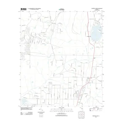
2012 Map of Compass Lake
USGS Topo · Published 2012About this map
Compass Lake serves as the central focal point of this Jackson County landscape, surrounded by a dense network of residential drives including Wisteria Ln and Coral Vine Dr. The area transitions from the settled lakeside community to a complex system of waterways and drainages, most notably Econfina Creek which winds through the center of the sheet. To the north, the Compass Lake Fire Tower stands as a significant landmark for forest management, while to the south, the settlement of Betts marks a crossroad near the Maran Airport.
Find a feature on this map
153 named features on this map. Tap any name to fly to it.
Don’t see what you’re looking for? This feature index may not catch every label — zoom into the map to look around manually.
Map Details
Editions of this 2012 Compass Lake Map
This is the sole edition of this map. No revisions or reprints were ever made.
Other maps of this area

1944 · Bennett
USGS Topo · 1:24,000

1945 · Juniper Creek
USGS Topo · 1:31,680

1945 · Bennett
USGS Topo · 1:31,680

1945 · Fountain
USGS Topo · 1:31,680

1950 · Wausau
USGS Topo · 1:24,000

1950 · Gap Lake
USGS Topo · 1:24,000

1951 · Wausau
USGS Topo · 1:24,000

1951 · Gap Pond
USGS Topo · 1:24,000

1952 · Kynesville
USGS Topo · 1:24,000

1952 · Alford SE
USGS Topo · 1:24,000