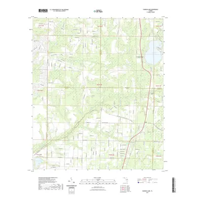
2021 Map of Compass Lake
USGS Topo · Published 2021About this map
Compass Lake serves as a central landmark at the junction of Jackson and Washington counties, surrounded by a dense network of local roads including Compass Lake Dr and Lakeview Cir. This area is defined by its complex hydrology, where Econfina Cr and Sweetwater Cr carve through the landscape, eventually passing under Econfina Bridge. The terrain shows a distinct shift from the wetlands of Cypress Swamp and Walker Bayou in the south to the higher elevations of Sandy Mountain. To the south, the settlement of Betts and the Maran Airport reflect the human footprint amidst the waterways. Farther west, Hammond Lake and Goshum Br emphasize the abundance of freshwater resources that have historically shaped land use and property boundaries across these four Florida counties.
Find a feature on this map
147 named features on this map. Tap any name to fly to it.
Don’t see what you’re looking for? This feature index may not catch every label — zoom into the map to look around manually.
Map Details
Editions of this 2021 Compass Lake Map
This is the sole edition of this map. No revisions or reprints were ever made.
Other maps of this area

1944 · Bennett
USGS Topo · 1:24,000

1945 · Juniper Creek
USGS Topo · 1:31,680

1945 · Bennett
USGS Topo · 1:31,680

1945 · Fountain
USGS Topo · 1:31,680

1950 · Wausau
USGS Topo · 1:24,000

1950 · Gap Lake
USGS Topo · 1:24,000

1951 · Wausau
USGS Topo · 1:24,000

1951 · Gap Pond
USGS Topo · 1:24,000

1952 · Kynesville
USGS Topo · 1:24,000

1952 · Alford SE
USGS Topo · 1:24,000