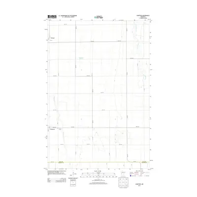
2013 Map of Comstock
USGS Topo · Published 2013About this map
Comstock serves as a primary hub of settlement in this part of the Red River Valley, appearing here alongside the smaller hamlet of Rustad to the north. This 2013 survey illustrates a landscape dominated by a precise orthogonal road grid, which structures the agricultural expanse of Clay Co down to the border of Wilkin Co. The hydrology of the region is defined by the winding course of the S Br Buffalo River in the northeast and Wolverton Cr snaking through the southwest. Local genealogy and community history are anchored by the Comstock Cem and the local Po, while the presence of the Ottertail River Reservoir indicates the controlled water management essential to this prairie environment. The map provides a clear look at the rural infrastructure, from established county highways like Cohwy-3 to the numerous numbered township roads that facilitate the region's farming economy.
Find a feature on this map
30 named features on this map. Tap any name to fly to it.
Don’t see what you’re looking for? This feature index may not catch every label — zoom into the map to look around manually.
Map Details
Editions of this 2013 Comstock Map
This is the sole edition of this map. No revisions or reprints were ever made.
Other maps of this area

1895 · Fargo
USGS Topo · 1:125,000

1897 · Fargo
USGS Topo · 1:125,000

1953 · Fargo
USGS Topo · 1:250,000

1956 · Fargo
USGS Topo · 1:250,000

1959 · Fargo South
USGS Topo · 1:24,000

1959 · Hickson
USGS Topo · 1:24,000

1959 · Christine
USGS Topo · 1:24,000

1964 · Sabin
USGS Topo · 1:24,000

1964 · Baker
USGS Topo · 1:24,000
1964 · Glyndon South
USGS Topo · 1:24,000