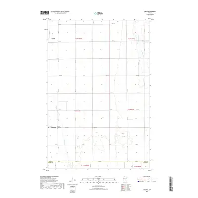
2019 Map of Comstock
USGS Topo · Published 2019About this map
Comstock and Rustad serve as the primary hubs in this agricultural landscape within Clay Co and Wilkin Co. The layout is defined by the rigid grid of the Public Land Survey System, with roads like 160th Ave S and Co Hwy 4 following section lines across the flat terrain. The Comstock Lutheran Cem stands as a central landmark for local genealogy, marking the spiritual and communal center for the surrounding farmsteads. Natural drainage patterns break the geometric order, most notably where the South Branch Buffalo River meanders through the northeast and Wolverton Cr flows near the western settlements. These waterways and the road network reveal a landscape optimized for large-scale farming while maintaining the small-town footprints established in earlier generations.
Find a feature on this map
29 named features on this map. Tap any name to fly to it.
Don’t see what you’re looking for? This feature index may not catch every label — zoom into the map to look around manually.
Map Details
Editions of this 2019 Comstock Map
This is the sole edition of this map. No revisions or reprints were ever made.
Other maps of this area

1895 · Fargo
USGS Topo · 1:125,000

1897 · Fargo
USGS Topo · 1:125,000

1953 · Fargo
USGS Topo · 1:250,000

1956 · Fargo
USGS Topo · 1:250,000

1959 · Fargo South
USGS Topo · 1:24,000

1959 · Hickson
USGS Topo · 1:24,000

1959 · Christine
USGS Topo · 1:24,000

1964 · Sabin
USGS Topo · 1:24,000

1964 · Baker
USGS Topo · 1:24,000
1964 · Glyndon South
USGS Topo · 1:24,000