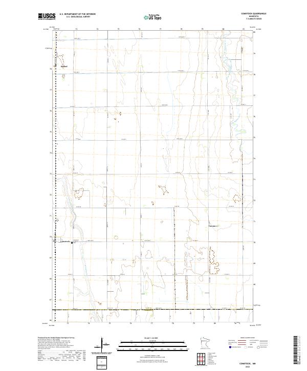
2022 Map of Comstock
USGS Topo · Published 2022About this map
Comstock and Rustad serve as the primary focal points of this Clay County landscape, where the flat agricultural terrain is defined by a rigorous grid of section lines and county roads. The settlement of Comstock is anchored by the Comstock Lutheran Cem, reflecting the area's ancestral ties and community history. Meandering watercourses break the geometric pattern of the plains, most notably the South Branch Buffalo River (also labeled as the S Br Buffalo River) and Wolverton Cr. These streams provide natural drainage for the extensive farmland that stretches across the townships of T138N, T137N, and T136N. The map illustrates a high degree of connectivity through a dense network of local routes like Co Hwy 4 and Co Rd 51, which facilitate movement between the scattered farmsteads and the county line shared with Wilkin County to the south.
Find a feature on this map
44 named features on this map. Tap any name to fly to it.
Don’t see what you’re looking for? This feature index may not catch every label — zoom into the map to look around manually.
Map Details
Editions of this 2022 Comstock Map
This is the sole edition of this map. No revisions or reprints were ever made.
Other maps of this area

1895 · Fargo
USGS Topo · 1:125,000

1897 · Fargo
USGS Topo · 1:125,000

1953 · Fargo
USGS Topo · 1:250,000

1956 · Fargo
USGS Topo · 1:250,000

1959 · Fargo South
USGS Topo · 1:24,000

1959 · Hickson
USGS Topo · 1:24,000

1959 · Christine
USGS Topo · 1:24,000

1964 · Sabin
USGS Topo · 1:24,000

1964 · Baker
USGS Topo · 1:24,000
1964 · Glyndon South
USGS Topo · 1:24,000