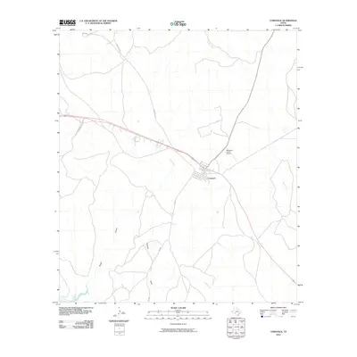
2010 Map of Comstock
USGS Topo · Published 2010About this map
Comstock serves as the primary hub for this stretch of the Trans-Pecos landscape, situated at a key crossroads where long-established ranch roads meet. The map reveals a land defined by its drainage systems, featuring the deep incisions of Rough Canyon and the winding paths of Cow Creek, Evans Creek, and Live Oak Creek. These watercourses dictate the movement of roads and the placement of remote infrastructure, such as the Robertson Ranch Airport positioned just northeast of the main settlement. The survey detail shows how transportation in this part of Val Verde County relies on a sparse network of designated routes like Ranch Rd 1024 and Zuberbueler Ranch Rd, which connect isolated homesteads and grazing lands. In the south, Chapote Draw cuts through the terrain, emphasizing the importance of ephemeral water paths in an arid environment where ranching remains the predominant way of life.
Find a feature on this map
10 named features on this map. Tap any name to fly to it.
Don’t see what you’re looking for? This feature index may not catch every label — zoom into the map to look around manually.
Map Details
Editions of this 2010 Comstock Map
This is the sole edition of this map. No revisions or reprints were ever made.
Other maps of this area

1941 · Feely
USGS Topo · 1:62,500

1943 · Shumla
USGS Topo · 1:62,500

1944 · Mouth Of Pecos
USGS Topo · 1:62,500

1944 · Baker Crossing
USGS Topo · 1:62,500

1958 · Del Rio
USGS Topo · 1:250,000

1964 · Del Rio
USGS Topo · 1:250,000

1972 · California Creek
USGS Topo · 1:24,000

1972 · Seminole Canyon
USGS Topo · 1:24,000
1972 · Zuberbueler Bend
USGS Topo · 1:24,000
1972 · Box Canyon
USGS Topo · 1:24,000