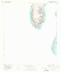
1972 Map of Zuberbueler Bend
USGS Topo · Published 1975About this map
Zuberbueler Bend forms a massive loop in the river landscape along the international boundary between Texas and Coahuila, Mexico. This 1970s survey captures the area following the creation of the Amistad Reservoir, which inundated the deep limestone canyons of the Rio Grande. The map shows the extent of the Amistad National Recreation Area, with specific attention to the jurisdictional boundary and areas subject to controlled inundation up to the 1144-foot elevation mark. The terrain is characterized by intricate contouring that reveals the complex drainage patterns and high ridges surrounding the submerged river valley, reflecting a significant era of hydraulic engineering and borderland water management.
Find a feature on this map
8 named features on this map. Tap any name to fly to it.
Don’t see what you’re looking for? This feature index may not catch every label — zoom into the map to look around manually.
Map Details
Editions of this 1972 Zuberbueler Bend Map
This is the sole edition of this map. No revisions or reprints were ever made.
Other maps of this area

1941 · Feely
USGS Topo · 1:62,500

1943 · Devils River
USGS Topo · 1:62,500

1944 · Devils River
USGS Topo · 1:62,500

1944 · Mouth Of Pecos
USGS Topo · 1:62,500

1958 · Del Rio
USGS Topo · 1:250,000

1964 · Del Rio
USGS Topo · 1:250,000
1972 · Zuberbueler Bend NW
USGS Topo · 1:24,000

1972 · Seminole Canyon
USGS Topo · 1:24,000
1972 · Box Canyon
USGS Topo · 1:24,000
1972 · Comstock
USGS Topo · 1:24,000