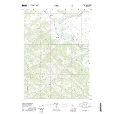
2023 Map of Conant Valley
USGS Topo · Published 2023About this map
The Snake River winds through the heart of this Idaho landscape, carving a fertile corridor between the high peaks of the Caribou Range and the Pine Creek Bench. Centered on the settlement of Swan Valley, the area is defined by the sharp transition from the irrigated riverside flats of Antelope Flat to the dense timber of the Caribou National Forest. A complex network of drainage systems, including Pritchard Creek and Fall Creek, feeds into the river, creating the distinct geography of Conant Valley and Staffel Island. The mountain terrain is crisscrossed by established tracks such as the Deadhorse Ridge Trl and Pritchard Creek Cutoff Trl, reflecting a landscape managed for both timber and recreation. Local history and genealogy researchers can trace named landmarks like Mineral Springs and the sheltered hollows of Indian Camp Hollow, which reveal the long-standing human presence in these remote canyons.
Find a feature on this map
49 named features on this map. Tap any name to fly to it.
Don’t see what you’re looking for? This feature index may not catch every label — zoom into the map to look around manually.
Map Details
Editions of this 2023 Conant Valley Map
This is the sole edition of this map. No revisions or reprints were ever made.
Other maps of this area

1924 · Hell Creek
USGS Topo · 1:62,500

1926 · Hell Creek
USGS Topo · 1:62,500

1932 · Irwin
USGS Topo · 1:96,000

1935 · Irwin
USGS Topo · 1:125,000

1943 · Garns Mtn
USGS Topo · 1:62,500

1946 · Garns Mtn
USGS Topo · 1:62,500

1951 · Heise SE
USGS Topo · 1:24,000

1955 · Driggs
USGS Topo · 1:250,000

1958 · Driggs
USGS Topo · 1:250,000

1962 · Driggs
USGS Topo · 1:250,000