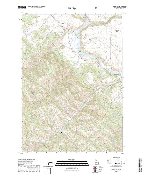
2024 Map of Conant Valley
USGS Topo · Published 2024About this map
The Snake River winds through the heart of this Idaho landscape, defining the northern boundary of the Caribou National Forest. Centered on the settlement of Swan Valley, the map captures a complex system of canyon drainages and high ridges within the Caribou Range. To the south, the dramatic drop of Fall Creek Falls marks the junction where Fall Creek meets the river. The topography is defined by significant elevation changes between the river valley and prominent features like Mahogany Ridge and Deadhorse Ridge.
Find a feature on this map
48 named features on this map. Tap any name to fly to it.
Don’t see what you’re looking for? This feature index may not catch every label — zoom into the map to look around manually.
Map Details
Editions of this 2024 Conant Valley Map
This is the sole edition of this map. No revisions or reprints were ever made.
Other maps of this area

1924 · Hell Creek
USGS Topo · 1:62,500

1926 · Hell Creek
USGS Topo · 1:62,500

1932 · Irwin
USGS Topo · 1:96,000

1935 · Irwin
USGS Topo · 1:125,000

1943 · Garns Mtn
USGS Topo · 1:62,500

1946 · Garns Mtn
USGS Topo · 1:62,500

1951 · Heise SE
USGS Topo · 1:24,000

1955 · Driggs
USGS Topo · 1:250,000

1958 · Driggs
USGS Topo · 1:250,000

1962 · Driggs
USGS Topo · 1:250,000