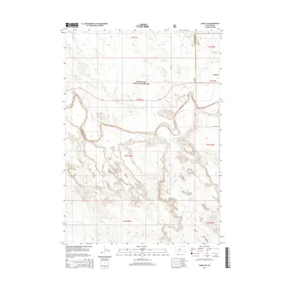
2015 Map of Conata NE
USGS Topo · Published 2015About this map
The northern reaches of the Buffalo Gap National Grassland dominate this section of the South Dakota plains, where the open prairie meets the complex topography of the Badlands. The small settlement of Interior sits in the northeastern corner of the sheet, serving as a gateway for travelers along Sn 44 and Riverview Rd. The landscape is defined by the winding course of Potato Cr, which carves through the southern half of the quadrangle. The boundary between Pennington and Jackson counties bisects the western portion of the map, illustrating the administrative divisions in this sparsely populated region. This survey captures a moment in the mid-2010s where traditional ranching land and public grasslands converge near the borders of national park territory.
Find a feature on this map
15 named features on this map. Tap any name to fly to it.
Don’t see what you’re looking for? This feature index may not catch every label — zoom into the map to look around manually.
Map Details
Editions of this 2015 Conata NE Map
This is the sole edition of this map. No revisions or reprints were ever made.
Other maps of this area

1950 · Conata
USGS Topo · 1:24,000

1950 · Interior
USGS Topo · 1:24,000

1950 · Conata SW
USGS Topo · 1:24,000

1950 · Potato Creek
USGS Topo · 1:24,000

1952 · Conata NE
USGS Topo · 1:24,000

1952 · Conata SE
USGS Topo · 1:24,000

1952 · Conata
USGS Topo · 1:24,000

1955 · Hot Springs
USGS Topo · 1:250,000

1955 · Martin
USGS Topo · 1:250,000

1958 · Martin
USGS Topo · 1:250,000