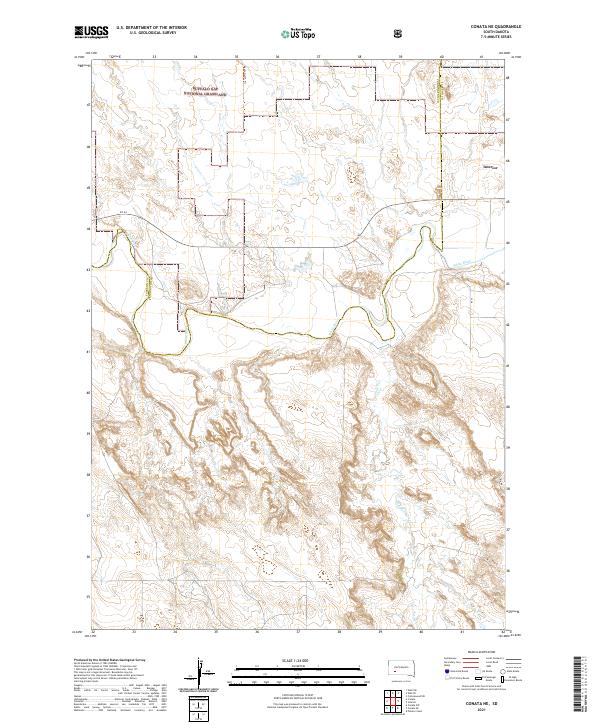
2021 Map of Conata NE
USGS Topo · Published 2021About this map
Buffalo Gap National Grassland dominates the northern landscape of this South Dakota quadrangle, where the Pennington and Jackson County line bisects a terrain defined by complex drainage patterns. The White River meanders across the central portion of the map, carving a distinctive valley that serves as a focal point for local geography and historic land use. To the south, the winding course of Potato Cr cuts through a highly dissected badlands topography, illustrating the erosive forces characteristic of the region. Transportation in this early 21st-century survey is represented by rural routes like Sn 44 and the Agate North Trl, which provide access through the grasslands. The boundary for Interior appears in the northeast, marking the proximity of established settlement to the open grazing lands and watercourses that have historically shaped this part of the Great Plains.
Find a feature on this map
18 named features on this map. Tap any name to fly to it.
Don’t see what you’re looking for? This feature index may not catch every label — zoom into the map to look around manually.
Map Details
Editions of this 2021 Conata NE Map
This is the sole edition of this map. No revisions or reprints were ever made.
Other maps of this area

1950 · Conata
USGS Topo · 1:24,000

1950 · Interior
USGS Topo · 1:24,000

1950 · Conata SW
USGS Topo · 1:24,000

1950 · Potato Creek
USGS Topo · 1:24,000

1952 · Conata NE
USGS Topo · 1:24,000

1952 · Conata SE
USGS Topo · 1:24,000

1952 · Conata
USGS Topo · 1:24,000

1955 · Hot Springs
USGS Topo · 1:250,000

1955 · Martin
USGS Topo · 1:250,000

1958 · Martin
USGS Topo · 1:250,000