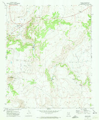
1971 Map of Concho
USGS Topo · Published 1973About this map
The settlement of Concho sits at the edge of the high desert, where water sources like Concho Lake and Concho Creek define the local geography. This early 1970s survey shows a developing residential grid evidenced by streets such as Concho Creek Drive, Ranch Drive, and Center Drive, alongside a local Golf Course. The landscape is dotted with critical water features essential for high-altitude ranching, including Ortega Spring, Malpais Spring, and the Hamblin Spr.
Find a feature on this map
34 named features on this map. Tap any name to fly to it.
Don’t see what you’re looking for? This feature index may not catch every label — zoom into the map to look around manually.
Map Details
Editions of this 1971 Concho Map
2 editions found
Other maps of this area

1886 · St Johns
USGS Topo · 1:250,000

1892 · St Johns
USGS Topo · 1:250,000

1954 · Saint Johns
USGS Topo · 1:250,000

1955 · Adamana 4 SW
USGS Topo · 1:24,000

1955 · Adamana 4 SE
USGS Topo · 1:24,000

1955 · Wolford Springs 3 SW
USGS Topo · 1:24,000

1955 · Hunt
USGS Topo · 1:62,500

1957 · Saint Johns
USGS Topo · 1:250,000

1958 · Saint Johns
USGS Topo · 1:250,000

1962 · Saint Johns
USGS Topo · 1:250,000