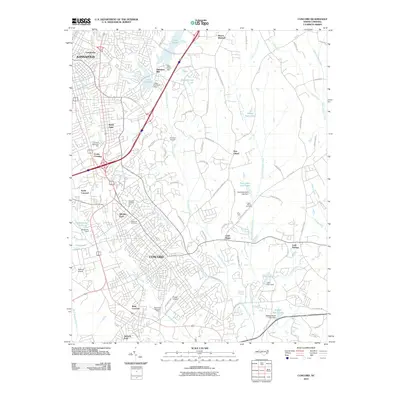
2010 Map of Concord
USGS Topo · Published 2010About this map
The city of Concord and the southern edge of Kannapolis anchor this 2010 topographic study, revealing a landscape defined by significant suburban expansion and water management. Modern corridors like Dale Earnhardt Blvd and Cloverleaf Pkwy navigate the urban center, while several small airfields including Chalfant Airport, Spencer Airport, and Propst Airport dot the outskirts. The region's genealogy and local history are preserved at Oakwood Cemetery and Saint James Cemetery, while recreation areas such as Jackson Park and Wil-Mar Park provide green space amidst the dense residential street network.
Find a feature on this map
82 named features on this map. Tap any name to fly to it.
Don’t see what you’re looking for? This feature index may not catch every label — zoom into the map to look around manually.
Map Details
Editions of this 2010 Concord Map
This is the sole edition of this map. No revisions or reprints were ever made.
Other maps of this area

1893 · Statesville
USGS Topo · 1:125,000

1941 · Charlotte
USGS Topo · 1:125,000

1942 · Charlotte
USGS Topo · 1:125,000

1949 · Kannapolis
USGS Topo · 1:24,000

1949 · Harrisburg
USGS Topo · 1:24,000

1949 · Concord SE
USGS Topo · 1:24,000

1950 · Concord
USGS Topo · 1:24,000

1953 · Charlotte
USGS Topo · 1:250,000

1954 · Charlotte
USGS Topo · 1:250,000

1957 · Mount Pleasant
USGS Topo · 1:62,500