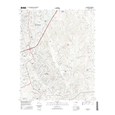
2016 Map of Concord
USGS Topo · Published 2016About this map
Concord and its surrounding suburbs appear here in a period of significant regional expansion. The landscape is defined by a dense network of residential developments and historic institutional landmarks, including the Cabarrus Coll of Health Sciences and established neighborhoods like Wil-Mar Park and Royal Oaks. The influence of the textile industry's legacy is visible at Heilmans Mill, while several small airfields such as Propst Airport and Chalfant Airport dot the outskirts of the city center. Hydrology plays a central role in the area's geography, with the winding paths of Irish Buffalo Cr and Cold Water Cr cutting through the terrain, alongside significant local reservoirs like Lake Fisher and Lake Concord. Large memorial spaces, including Oakwood Cem and Rutherford Memorial Park, provide important reference points for genealogists tracking local families.
Find a feature on this map
44 named features on this map. Tap any name to fly to it.
Don’t see what you’re looking for? This feature index may not catch every label — zoom into the map to look around manually.
Map Details
Editions of this 2016 Concord Map
This is the sole edition of this map. No revisions or reprints were ever made.
Other maps of this area

1893 · Statesville
USGS Topo · 1:125,000

1941 · Charlotte
USGS Topo · 1:125,000

1942 · Charlotte
USGS Topo · 1:125,000

1949 · Kannapolis
USGS Topo · 1:24,000

1949 · Harrisburg
USGS Topo · 1:24,000

1949 · Concord SE
USGS Topo · 1:24,000

1950 · Concord
USGS Topo · 1:24,000

1953 · Charlotte
USGS Topo · 1:250,000

1954 · Charlotte
USGS Topo · 1:250,000

1957 · Mount Pleasant
USGS Topo · 1:62,500