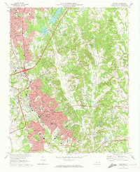
1969 Map of Concord
USGS Topo · Published 1973About this map
Concord serves as the focal point of this Piedmont landscape, appearing here as a growing urban center during a period of significant expansion. The map captures the city's educational and institutional fabric, featuring Barber-Scotia College and various local landmarks such as the County Mem Hospital and Rutherford Mem Park. To the north, the industrial footprint of Kannapolis and Royal Oaks is evident, linked to the central city by the Southern railroad line.
Find a feature on this map
71 named features on this map. Tap any name to fly to it.
Don’t see what you’re looking for? This feature index may not catch every label — zoom into the map to look around manually.
Map Details
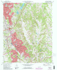
Editions of this 1969 Concord Map
2 editions found
Other maps of this area

1893 · Statesville
USGS Topo · 1:125,000

1941 · Charlotte
USGS Topo · 1:125,000

1942 · Charlotte
USGS Topo · 1:125,000

1949 · Kannapolis
USGS Topo · 1:24,000

1949 · Harrisburg
USGS Topo · 1:24,000

1949 · Concord SE
USGS Topo · 1:24,000

1950 · Concord
USGS Topo · 1:24,000

1953 · Charlotte
USGS Topo · 1:250,000

1954 · Charlotte
USGS Topo · 1:250,000

1957 · Mount Pleasant
USGS Topo · 1:62,500