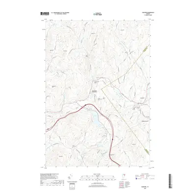
2018 Map of Concord
USGS Topo · Published 2018About this map
East Saint Johnsbury and the village of Concord anchor this landscape along the Moose River in the late 2010s. The area is defined by a dense network of country cemeteries and family-named landmarks, reflecting generations of settlement in Caledonia County. Significant burial grounds such as Adams-Babcock Cem, Cushman Cem, and Powers Wheeler Cem are preserved among the hills.
Find a feature on this map
84 named features on this map. Tap any name to fly to it.
Don’t see what you’re looking for? This feature index may not catch every label — zoom into the map to look around manually.
Map Details
Editions of this 2018 Concord Map
This is the sole edition of this map. No revisions or reprints were ever made.
Other maps of this area

1931 · Littleton
USGS Topo · 1:62,500

1932 · Littleton
USGS Topo · 1:48,000

1935 · Littleton
USGS Topo · 1:62,500

1935 · Lyndonville
USGS Topo · 1:48,000

1938 · St. Johnsbury
USGS Topo · 1:48,000

1939 · Lyndonville
USGS Topo · 1:62,500

1943 · St. Johnsbury
USGS Topo · 1:62,500
1949 · St. Johnsbury
USGS Topo · 1:62,500

1950 · Lake Champlain
USGS Topo · 1:250,000

1950 · Lewiston
USGS Topo · 1:250,000