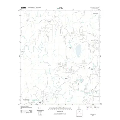
2011 Map of Concord
USGS Topo · Published 2011About this map
Valley Creek and its many tributaries, including Lick Creek and Johnson Branch, carve through this Jefferson County landscape where the legacy of Alabamian industry remains visible. Several impoundments and dams associated with local operations are prominent, such as the Blue Creek Mine Number 3-Impoundment and Concord Mine Lake. These features, alongside the Virginia Mines Cemetery and Valley Creek Cemetery, point to the generations of families who settled in communities like Virginia, Adger, and Concord. The terrain is marked by significant elevations including Clarke Mountain and West Rock Mountain, while legacy river crossings like Starvacre Ford remind researchers of older transit routes through the creek valleys. Modern community hubs are represented by the Adger Post Office and Leaning Oak Golf Course, showing the gradual shift from industrial work to residential development south of Birmingham.
Find a feature on this map
127 named features on this map. Tap any name to fly to it.
Don’t see what you’re looking for? This feature index may not catch every label — zoom into the map to look around manually.
Map Details
Editions of this 2011 Concord Map
This is the sole edition of this map. No revisions or reprints were ever made.
Other maps of this area

1889 · Birmingham
USGS Topo · 1:125,000

1890 · Bessemer
USGS Topo · 1:125,000

1892 · Birmingham
USGS Topo · 1:125,000

1892 · Bessemer
USGS Topo · 1:125,000

1893 · Jasper
USGS Topo · 1:125,000

1895 · Birmingham
USGS Topo · 1:125,000

1899 · Brookwood
USGS Topo · 1:125,000

1904 · Birmingham Coal District
USGS Topo · 1:62,500

1905 · Bessemer Iron District
USGS Topo · 1:62,500

1906 · Birmingham Special
USGS Topo · 1:62,500