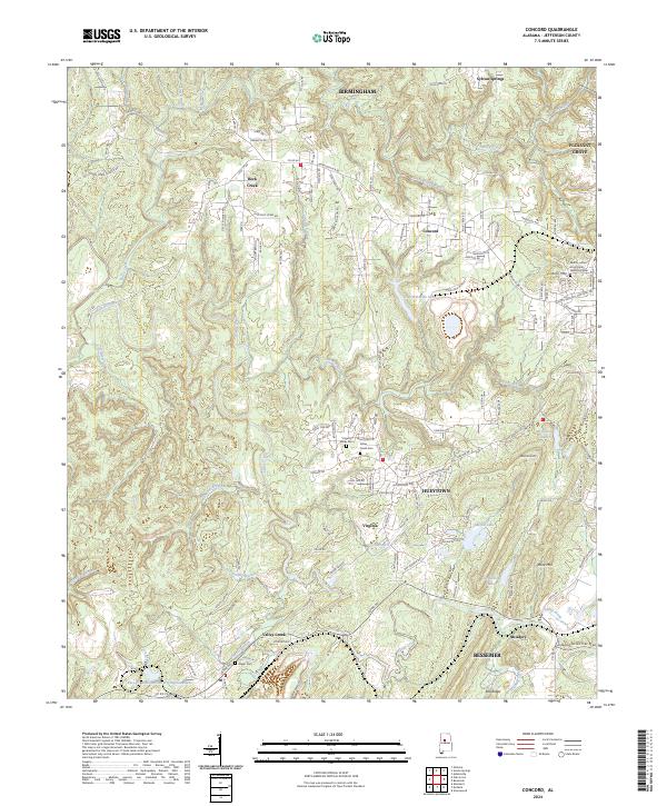
2024 Map of Concord
USGS Topo · Published 2024About this map
Rock Creek and its many tributaries, such as Roscoe Spring Branch and Little Lick Creek, carve through the complex topography of western Jefferson County. This landscape is defined by its industrial legacy, visible in the substantial water bodies created by mining operations, including the Concord Mine Lake and the large Blue Cr Mine Number 3 Impoundment near the southern edge. The residential patterns of Concord, Hueytown, and Virginia are tightly integrated with this rugged terrain, often following ridges like West Rock Mtn. For genealogists, the map identifies several significant resting places, such as the Valley Creek Cem and the Martin Luther King Junior Memorial Cem, providing precise locations for family research. The network of local roads like Warrior River Rd and Taylors Ferry Rd serves as the primary skeleton for the dispersed settlements that characterize this portion of the Birmingham metropolitan fringe.
Find a feature on this map
147 named features on this map. Tap any name to fly to it.
Don’t see what you’re looking for? This feature index may not catch every label — zoom into the map to look around manually.
Map Details
Editions of this 2024 Concord Map
This is the sole edition of this map. No revisions or reprints were ever made.
Other maps of this area

1889 · Birmingham
USGS Topo · 1:125,000

1890 · Bessemer
USGS Topo · 1:125,000

1892 · Birmingham
USGS Topo · 1:125,000

1892 · Bessemer
USGS Topo · 1:125,000

1893 · Jasper
USGS Topo · 1:125,000

1895 · Birmingham
USGS Topo · 1:125,000

1899 · Brookwood
USGS Topo · 1:125,000

1904 · Birmingham Coal District
USGS Topo · 1:62,500

1905 · Bessemer Iron District
USGS Topo · 1:62,500

1906 · Birmingham Special
USGS Topo · 1:62,500