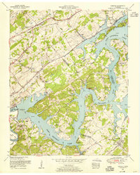
1953 Map of Concord
USGS Topo · Published 1955About this map
The Fort Loudoun Dam anchors this mid-century survey, marking the intersection where the Tennessee River meets the Little Tennessee River. This landscape is defined by the massive reservoir waters of Fort Loudoun Lake and Watts Bar Lake, which wrap around intricate peninsulae like Choto Bend and Parks Bend. These newer impoundments contrast with the established rail-and-road network, including the Southern Railway through Concord and the Louisville and Nashville Railroad serving Friendsville. Local heritage is visible in the many rural landmarks such as Shady Grove Church, Union Valley School, and the Leeper Cemetery near Boyd. From the commercial activity at Dixie Lee Junction to specialized sites like the Minnow rearing pools, the map documents a region balancing its agrarian roots with the transformative hydroelectric infrastructure of the Tennessee Valley Authority.
Find a feature on this map
55 named features on this map. Tap any name to fly to it.
Don’t see what you’re looking for? This feature index may not catch every label — zoom into the map to look around manually.
Map Details
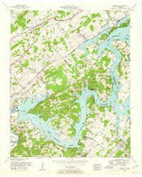
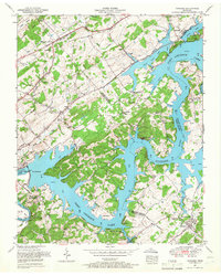
Editions of this 1953 Concord Map
3 editions found
Other maps of this area

1895 · Loudon
USGS Topo · 1:125,000

1935 · Binfield
USGS Topo · 1:24,000

1935 · Meadow
USGS Topo · 1:24,000

1935 · Lenoir City
USGS Topo · 1:24,000

1935 · Bethel Valley
USGS Topo · 1:24,000

1935 · Bearden
USGS Topo · 1:24,000

1935 · Lovell
USGS Topo · 1:24,000

1936 · Louisville
USGS Topo · 1:24,000

1936 · Friendship
USGS Topo · 1:48,000

1936 · Loudon
USGS Topo · 1:24,000