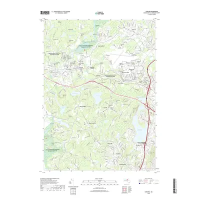
2018 Map of Concord
USGS Topo · Published 2018About this map
Minute Man National Historical Park preserves a core corridor of American revolutionary heritage, marking the landscape from Concord east toward Meriams Corner. The map meticulously details the intersection of early colonial history and modern infrastructure, where the Old North Bridge and the Grave of British Soldiers sit adjacent to the active runways of Laurence G Hanscom Field. This layer of military presence continues at Hanscom AFB, showing how the 20th-century defense footprint integrated into the existing topography of the Bedford Levels. Further south, the literary and environmental legacy of the region is centered on Walden Pond, surrounded by preserved spaces like the Great Meadows National Wildlife Refuge. The settlement patterns of Lincoln, South Lincoln, and Silver Hill are clearly defined alongside the Mbta rail corridor, while numerous burial sites like Sleepy Hollow Cem and the Old Hill Burying Ground offer significant genealogical value.
Find a feature on this map
303 named features on this map. Tap any name to fly to it.
Don’t see what you’re looking for? This feature index may not catch every label — zoom into the map to look around manually.
Map Details
Editions of this 2018 Concord Map
This is the sole edition of this map. No revisions or reprints were ever made.
Other maps of this area

1886 · Lawrence
USGS Topo · 1:62,500

1886 · Lowell
USGS Topo · 1:62,500

1886 · Framingham
USGS Topo · 1:62,500

1888 · Lawrence
USGS Topo · 1:62,500

1889 · Framingham
USGS Topo · 1:62,500

1893 · Lowell
USGS Topo · 1:62,500

1893 · Boston
USGS Topo · 1:62,500

1893 · Lawrence
USGS Topo · 1:62,500

1894 · Framingham
USGS Topo · 1:62,500

1903 · Boston
USGS Topo · 1:62,500