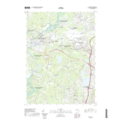
2021 Map of Concord
USGS Topo · Published 2021About this map
The Old North Bridge and the Grave of British Soldiers stand as central landmarks in this documentation of a landscape defined by American Revolutionary history. Within the Minute Man National Historical Park, the map traces Revolutionary Ridge and the Battle Road Trail, while the conservation lands of the Great Meadows National Wildlife Refuge preserve the riparian corridors of the Concord River. To the east, the modern military footprint of Hanscom Air Force Base contrasts with the quiet preservation of literary sites like Walden Pond and Thoreau Bog. The settlement pattern follows a network of historic townships, from the bustling center of Waltham and the transit hub at South Lincoln to the quieter residential and academic grounds surrounding the National Aviation Academy of New England.
Find a feature on this map
222 named features on this map. Tap any name to fly to it.
Don’t see what you’re looking for? This feature index may not catch every label — zoom into the map to look around manually.
Map Details
Editions of this 2021 Concord Map
This is the sole edition of this map. No revisions or reprints were ever made.
Other maps of this area

1886 · Lawrence
USGS Topo · 1:62,500

1886 · Lowell
USGS Topo · 1:62,500

1886 · Framingham
USGS Topo · 1:62,500

1888 · Lawrence
USGS Topo · 1:62,500

1889 · Framingham
USGS Topo · 1:62,500

1893 · Lowell
USGS Topo · 1:62,500

1893 · Boston
USGS Topo · 1:62,500

1893 · Lawrence
USGS Topo · 1:62,500

1894 · Framingham
USGS Topo · 1:62,500

1903 · Boston
USGS Topo · 1:62,500