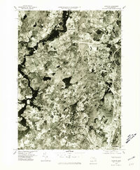
1977 Map of Concord
USGS Topo · Published 1981About this map
The confluence of the Assabet River and the Sudbury River forms the headwaters of the Concord River, defining the western edge of this 1977 orthophotoquad. This aerial perspective, captured just after the mid-century suburban expansion, provides a photographic record of the landscape surrounding Concord and Lexington. The map reveals the intricate patterns of residential growth and preserved open space typical of these Middlesex County communities during the late 1970s.
Find a feature on this map
11 named features on this map. Tap any name to fly to it.
Don’t see what you’re looking for? This feature index may not catch every label — zoom into the map to look around manually.
Map Details
Editions of this 1977 Concord Map
This is the sole edition of this map. No revisions or reprints were ever made.
Other maps of this area

1886 · Lawrence
USGS Topo · 1:62,500

1886 · Lowell
USGS Topo · 1:62,500

1886 · Framingham
USGS Topo · 1:62,500

1888 · Lawrence
USGS Topo · 1:62,500

1889 · Framingham
USGS Topo · 1:62,500

1893 · Lowell
USGS Topo · 1:62,500

1893 · Boston
USGS Topo · 1:62,500

1893 · Lawrence
USGS Topo · 1:62,500

1894 · Framingham
USGS Topo · 1:62,500

1903 · Boston
USGS Topo · 1:62,500