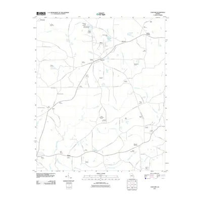
2011 Map of Concord
USGS Topo · Published 2011About this map
Concord serves as a central hub for this portion of Georgia, where a dense network of country roads connects family settlements and agricultural lands. The landscape is defined by its small aviation history and numerous ancestral burial grounds, including the Magnolia Cemetery and Hebron Cemetery. Private flight facilities like the Triple Snap Ranch Airport and Windrift Aerodrome suggest a community where local transport extends beyond the road network. To the east, the terrain rises toward Buzzard Mountain, while the hydrology is shaped by several watercourses including Elkins Creek and Bull Creek. The map documents a deeply rooted rural community, evident in the sheer number of named cemeteries such as Barker Cemetery, Beckham Cemetery, and the Pleasant Hill Cemetery near Concord Road, which provide valuable location data for genealogists tracing regional family lineages.
Find a feature on this map
92 named features on this map. Tap any name to fly to it.
Don’t see what you’re looking for? This feature index may not catch every label — zoom into the map to look around manually.
Map Details
Editions of this 2011 Concord Map
This is the sole edition of this map. No revisions or reprints were ever made.
Other maps of this area

1907 · Talbotton
USGS Topo · 1:125,000

1934 · Warm Springs
USGS Topo · 1:62,500

1935 · Thomaston
USGS Topo · 1:48,000

1936 · Warm Springs
USGS Topo · 1:62,500

1939 · Thomaston
USGS Topo · 1:62,500

1953 · Atlanta
USGS Topo · 1:250,000

1955 · Phenix City
USGS Topo · 1:250,000

1957 · Phenix City
USGS Topo · 1:250,000

1957 · Atlanta
USGS Topo · 1:250,000

1958 · Phenix City
USGS Topo · 1:250,000