2024 Map of Concord
USGS Topo · Published 2024About this map
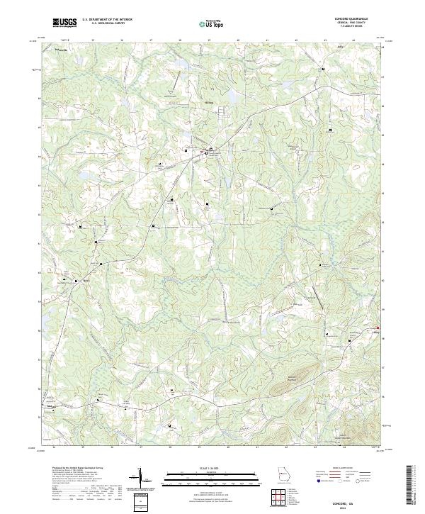
Concord serves as a central hub in Pike County, defined by its position along the Norfolk Southern line and a dense concentration of civic and spiritual sites. The landscape is heavily marked by genealogy-rich locations such as Magnolia Cem and Concord Baptist Church Cem, reflecting the deep-rooted community history of the area. To the south, the terrain rises toward Buzzard Mountain and Indian Grave Mountain, where the network of rural routes like S Madden Bridge Rd and Smyrna Church Rd navigate the drainages of Mountain Creek and Tenmile Creek. This modern survey also highlights a peculiar abundance of private aviation fields, including the Flying 'H' Ranch Airport and the Windrift Aerodrome, suggesting a transition in land use from traditional agriculture to private rural estates. Smaller settlements like Neal and Molena anchor the western edge, each preserving family-named landmarks like the Jordan and Willis Cem.
Find a feature on this map
120 named features on this map. Tap any name to fly to it.
Don’t see what you’re looking for? This feature index may not catch every label — zoom into the map to look around manually.
Map Details
Editions of this 2024 Concord Map
This is the sole edition of this map. No revisions or reprints were ever made.
