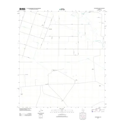
2013 Map of Concordia
USGS Topo · Published 2013About this map
Concordia anchors this coastal plain landscape in Nueces County, where a highly organized grid of county roads and farm-to-market routes facilitates a vast agricultural network. The presence of numerous named water-extraction points, including Palma Windmill, Mota Redonda Windmill, and Noria Honda Windmill, highlights the critical importance of water management in this semi-arid Texas environment. The terrain is drained by the winding courses of Chiltipin Creek and Petronila Cr, which contrast with the straight lines of the surrounding property boundaries.
Find a feature on this map
31 named features on this map. Tap any name to fly to it.
Don’t see what you’re looking for? This feature index may not catch every label — zoom into the map to look around manually.
Map Details
Editions of this 2013 Concordia Map
This is the sole edition of this map. No revisions or reprints were ever made.
Other maps of this area

1924 · Petronilla
USGS Topo · 1:62,500

1928 · Sarita
USGS Topo · 1:125,000

1950 · Corpus Christi
USGS Topo · 1:250,000

1951 · Riviera Beach NE
USGS Topo · 1:24,000

1952 · Riviera Beach NW
USGS Topo · 1:24,000

1952 · Riviera Beach
USGS Topo · 1:62,500

1954 · Kingsville
USGS Topo · 1:62,500

1954 · Petronila
USGS Topo · 1:62,500

1954 · Riviera
USGS Topo · 1:62,500

1956 · Corpus Christi
USGS Topo · 1:250,000