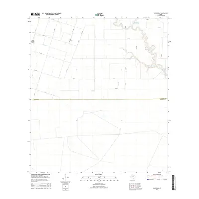
2016 Map of Concordia
USGS Topo · Published 2016About this map
Saint Paul Cem sits at a rural crossroads in this coastal prairie landscape, reflecting the agricultural roots of northern Kleberg and southern Nueces Counties. The area is defined by its drainage patterns, with Chiltipin Cr winding through the western portion while Petronila Creek and the small Gertrude Lubby Lake anchor the northeastern corner. Aviation infrastructure is represented by the Bishop Municipal Airport, located near the intersection of several county roads. The map reveals a strictly organized grid of transport, where farm-to-market routes like FM 70 and FM 892 connect scattered homesteads and fields. This 2016 survey captures the persistent rural character of the Texas gulf coast hinterlands, showing how modern county boundaries like the Nueces Co Kleberg Co line divide a landscape primarily dedicated to industrial-scale farming and local transit.
Find a feature on this map
23 named features on this map. Tap any name to fly to it.
Don’t see what you’re looking for? This feature index may not catch every label — zoom into the map to look around manually.
Map Details
Editions of this 2016 Concordia Map
This is the sole edition of this map. No revisions or reprints were ever made.
Other maps of this area

1924 · Petronilla
USGS Topo · 1:62,500

1928 · Sarita
USGS Topo · 1:125,000

1950 · Corpus Christi
USGS Topo · 1:250,000

1951 · Riviera Beach NE
USGS Topo · 1:24,000

1952 · Riviera Beach NW
USGS Topo · 1:24,000

1952 · Riviera Beach
USGS Topo · 1:62,500

1954 · Kingsville
USGS Topo · 1:62,500

1954 · Petronila
USGS Topo · 1:62,500

1954 · Riviera
USGS Topo · 1:62,500

1956 · Corpus Christi
USGS Topo · 1:250,000