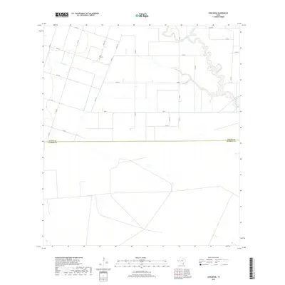
2019 Map of Concordia
USGS Topo · Published 2019About this map
Saint Paul Cem sits as a solitary point of local history in this rural landscape of southern Texas, located just north of the county boundary between Nueces County and Kleberg County. The area is defined by the winding course of Petronila Creek and the smaller Petronila Cr to the east, while Chiltipin Cr drains the western portion of the quadrant. Water is a primary feature of this agricultural region, highlighted by Gertrude Lubby Lake and the various drainage channels that crisscross the flat coastal plains. A grid of county roads, such as Co RD 10 and Co RD 12, along with state farm roads like FM 70 and FM 892, provide the only infrastructure in this sparsely settled region, where large parcels of land are partitioned by these long-standing transport corridors.
Find a feature on this map
22 named features on this map. Tap any name to fly to it.
Don’t see what you’re looking for? This feature index may not catch every label — zoom into the map to look around manually.
Map Details
Editions of this 2019 Concordia Map
This is the sole edition of this map. No revisions or reprints were ever made.
Other maps of this area

1924 · Petronilla
USGS Topo · 1:62,500

1928 · Sarita
USGS Topo · 1:125,000

1950 · Corpus Christi
USGS Topo · 1:250,000

1951 · Riviera Beach NE
USGS Topo · 1:24,000

1952 · Riviera Beach NW
USGS Topo · 1:24,000

1952 · Riviera Beach
USGS Topo · 1:62,500

1954 · Kingsville
USGS Topo · 1:62,500

1954 · Petronila
USGS Topo · 1:62,500

1954 · Riviera
USGS Topo · 1:62,500

1956 · Corpus Christi
USGS Topo · 1:250,000