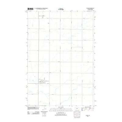
2012 Map of Conde
USGS Topo · Published 2012About this map
The town of Conde anchors the southern portion of this landscape, showing a structured grid of streets including Maple St, Birch St, and Broadway St NE. Further north, the smaller settlement of Verdon sits near the headwaters of Dry Run, a seasonal drainage that meanders across the prairie. The layout of the region is defined by a rigid section-line road system, with numbered routes like 405th Ave and 148th St creating a patchwork of agricultural plots typical of northeastern South Dakota.
Find a feature on this map
33 named features on this map. Tap any name to fly to it.
Don’t see what you’re looking for? This feature index may not catch every label — zoom into the map to look around manually.
Map Details
Editions of this 2012 Conde Map
This is the sole edition of this map. No revisions or reprints were ever made.
Other maps of this area

1894 · Conde
USGS Topo · 1:62,500

1895 · Aberdeen
USGS Topo · 1:125,000

1953 · Groton SW
USGS Topo · 1:24,000

1953 · Milbank
USGS Topo · 1:250,000

1954 · Ferney
USGS Topo · 1:24,000

1954 · Aberdeen
USGS Topo · 1:250,000

1956 · Aberdeen
USGS Topo · 1:250,000

1958 · Milbank
USGS Topo · 1:250,000
1958 · Randolph
USGS Topo · 1:24,000
1958 · Conde
USGS Topo · 1:24,000