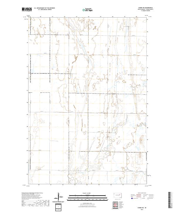
2021 Map of Conde SW
USGS Topo · Published 2021About this map
Timber Cr meanders across this rural section of Spink County, defining the drainage patterns of a landscape primarily structured by the Public Land Survey System. The map shows the intersection of four townships, including t119n r62w and t118n r61w, where the prairie is organized by a precise grid of county roads and section lines. These corridors, such as Co Rd 7 and Co Rd 5, represent the essential infrastructure of South Dakota’s agricultural heartland. While the terrain appears largely open, the intricate network of wetlands and seasonal watercourses indicates the subtle relief and hydrological complexity of the James River Valley region during the early 21st century. The map serves as a record of land divisions and rural thoroughfares like 164th St and 157th St, which provide the primary access to the remote farmsteads and fields of the area.
Find a feature on this map
22 named features on this map. Tap any name to fly to it.
Don’t see what you’re looking for? This feature index may not catch every label — zoom into the map to look around manually.
Map Details
Editions of this 2021 Conde SW Map
This is the sole edition of this map. No revisions or reprints were ever made.
Other maps of this area

1894 · Conde
USGS Topo · 1:62,500

1895 · Byron
USGS Topo · 1:125,000

1895 · Aberdeen
USGS Topo · 1:125,000

1953 · Brentford
USGS Topo · 1:24,000

1953 · Frankfort
USGS Topo · 1:24,000

1953 · Huron
USGS Topo · 1:250,000

1954 · Aberdeen
USGS Topo · 1:250,000

1954 · Huron
USGS Topo · 1:250,000

1956 · Aberdeen
USGS Topo · 1:250,000
1958 · Randolph
USGS Topo · 1:24,000