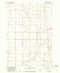
1960 Map of Conde SW
USGS Topo · Published 1961About this map
Benton and Sumner townships define the open agricultural character of this Spink County landscape during the early 1960s. Surveyed as part of a Missouri River Basin development program, the map details a grid of rural section lines interrupted only by the wandering course of Timber Creek in the south. The area is marked by a reliance on groundwater, indicated by several instances of Flowing Well scattered across the plains.
Find a feature on this map
9 named features on this map. Tap any name to fly to it.
Don’t see what you’re looking for? This feature index may not catch every label — zoom into the map to look around manually.
Map Details
Editions of this 1960 Conde SW Map
This is the sole edition of this map. No revisions or reprints were ever made.
Other maps of this area

1894 · Conde
USGS Topo · 1:62,500

1895 · Byron
USGS Topo · 1:125,000

1895 · Aberdeen
USGS Topo · 1:125,000

1953 · Brentford
USGS Topo · 1:24,000

1953 · Frankfort
USGS Topo · 1:24,000

1953 · Huron
USGS Topo · 1:250,000

1954 · Aberdeen
USGS Topo · 1:250,000

1954 · Huron
USGS Topo · 1:250,000

1956 · Aberdeen
USGS Topo · 1:250,000
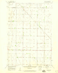
1958 · Randolph
USGS Topo · 1:24,000