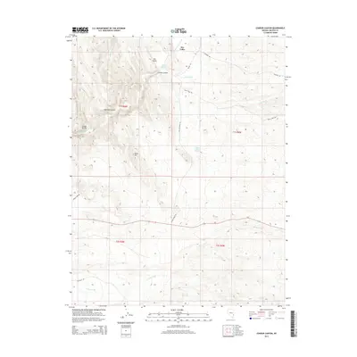
2014 Map of Condor Canyon
USGS Topo · Published 2014About this map
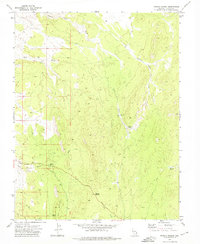
Condor Canyon dominates this arid Lincoln County landscape, where complex drainage patterns define the territory near the turn of the 21st century. The map illustrates a network of seasonal watercourses, including White Wash, Patterson Wash, and Meadow Valley Wash, which have carved deep features like Hamlight Canyon and Condor Ravine. Life in this high-desert environment is anchored by isolated water sources such as Delmues Springs, Meadow Valley Spring, and the Big Flat Reservoir. This area is characterized by its ranching and resource-access infrastructure, with named roads like Delmue Ranch Rd and Panaca Tank Rd connecting the lowlands to the heights of Black Hill. The landscape's transition from the open expanse of Dry Valley to these rugged corridors reflects the essential relationship between water management and Nevada's high-desert geography.
Find a feature on this map
22 named features on this map. Tap any name to fly to it.
Don’t see what you’re looking for? This feature index may not catch every label — zoom into the map to look around manually.
Map Details
Editions of this 2014 Condor Canyon Map
This is the sole edition of this map. No revisions or reprints were ever made.
Other maps of this area

1885 · Pioche
USGS Topo · 1:250,000

1886 · Pioche
USGS Topo · 1:250,000

1921 · NW 1/4 Panaca
USGS Topo · 1:48,000

1953 · Pioche
USGS Topo · 1:24,000

1954 · Caliente
USGS Topo · 1:250,000

1959 · Caliente
USGS Topo · 1:250,000
1970 · Panaca
USGS Topo · 1:24,000
1970 · Condor Canyon
USGS Topo · 1:24,000
1970 · Rose Valley
USGS Topo · 1:24,000
1972 · Panaca Summit
USGS Topo · 1:24,000