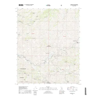
2018 Map of Condor Peak
USGS Topo · Published 2018About this map
The San Gabriel Mountains dominate this 2018 survey, characterized by deep-cut drainages and high-altitude peaks within the Angeles National Forest. Significant elevation changes are marked by Condor Peak, Josephine Peak, and Mt Lukens, which overlooks the northern reaches of Glendale and Pasadena. The landscape is defined by the complex water systems of Big Tujunga Creek and Pacoima Wash, where early canyon settlements like Vogel Flat and Wildwood are situated along the valley floor. Transportation through this steep terrain relies on the winding Big Tujunga Canyon Road and the Angeles Forest Highway. Small canyon enclaves like Singing Springs and Hidden Springs are shown along the watercourses, while numerous fire roads and trails, including the Mendenhall Truck Trail, provide access to the interior ridges.
Find a feature on this map
75 named features on this map. Tap any name to fly to it.
Don’t see what you’re looking for? This feature index may not catch every label — zoom into the map to look around manually.
Map Details
Editions of this 2018 Condor Peak Map
This is the sole edition of this map. No revisions or reprints were ever made.
Other maps of this area

1894 · Los Angeles
USGS Topo · 1:62,500

1896 · Pasadena
USGS Topo · 1:62,500

1896 · Santa Monica
USGS Topo · 1:62,500

1898 · Santa Monica
USGS Topo · 1:62,500

1900 · Pasadena
USGS Topo · 1:62,500

1900 · Tujunga
USGS Topo · 1:62,500

1900 · Los Angeles
USGS Topo · 1:62,500

1900 · Fernando
USGS Topo · 1:62,500

1901 · Southern California Sheet No. 1
USGS Topo · 1:250,000

1902 · Santa Monica
USGS Topo · 1:62,500