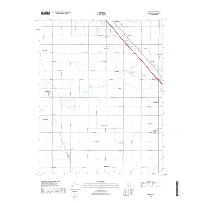
2018 Map of Conejo
USGS Topo · Published 2018About this map
The agricultural landscape of the San Joaquin Valley is defined by a dense network of irrigation infrastructure and rural settlements south of Fresno. Centered between the towns of Fowler and Selma, the region relies on an intricate system of waterways including the Fowler Switch Canal, Iowa Ditch, and Kirby Canal to support the surrounding orchards and fields. Small unincorporated communities like Monmouth, Conejo, and Wildflower are situated along the grid-patterned road network, often centered on intersections of major thoroughfares like Golden State Blvd. Local aviation is prominent in this corridor, with Selma Airport, Quinn Airport, and Central Valley Aviation Inc Airport scattered throughout the farmland. Numerous family-named ponds, such as Helmke Pond and Prather Pond, suggest a history of private water management and land ownership in this vital section of the Central Valley.
Find a feature on this map
60 named features on this map. Tap any name to fly to it.
Don’t see what you’re looking for? This feature index may not catch every label — zoom into the map to look around manually.
Map Details
Editions of this 2018 Conejo Map
This is the sole edition of this map. No revisions or reprints were ever made.
Other maps of this area

1923 · Malaga
USGS Topo · 1:31,680

1923 · Fresno
USGS Topo · 1:31,680

1923 · Sanger
USGS Topo · 1:31,680

1924 · Riverdale
USGS Topo · 1:31,680

1924 · Selma
USGS Topo · 1:31,680

1924 · Conejo
USGS Topo · 1:31,680

1925 · Caruthers
USGS Topo · 1:31,680

1926 · Burris Park
USGS Topo · 1:31,680

1927 · Laton
USGS Topo · 1:31,680

1927 · Riverdale
USGS Topo · 1:31,680